Free Printable List of 50 States (PDF) – Looking for a free printable list of the 50 states? Whether you are a teacher preparing a U.S. geography unit, a homeschool parent, or simply want a quick reference for the states and their capitals, a clean one-page printable makes learning easier.
This resource page explains what a useful printable list of the 50 states includes, why it helps, and where to download legitimate free versions without sign-ups or paywalls.
Why Use a Free Printable List of the 50 States?
A printable list of the 50 states typically shows all states in alphabetical order. Many versions also include two-letter postal abbreviations and capital cities. Some add Census regions or a blank version for practice.
These sheets work well for:
- Classroom reference folders and quizzes
- Homeschool geography lessons
- Quick study before a states-and-capitals test
- Road-trip planning or family activities
Black-and-white designs save ink and print clearly on standard letter-size paper.
What a Good Printable List of 50 States Includes?
Look for these features in a free printable:
- All 50 states listed alphabetically
- State capitals next to each name
- Two-letter abbreviations (AL, AK, AZ, etc.)
- Clear, readable fonts and minimal clutter
- Optional blank version for fill-in practice
Washington, D.C. is the national capital but is not a state, so reliable lists note that distinction.
Trusted Places to Download a Free Printable List
Here are current, legitimate sources that offer free downloads for personal, classroom, or educational use.
One straightforward alphabetical list with capitals is available from The Art Kit. The free printable shows every state and its capital on a single page ready for home or classroom printers.
Download the free 50 states and capitals list from The Art Kit
The Facts Institute provides black-and-white printable PDFs of the 50 states with capitals and abbreviations, designed to save ink.
Get the free printable list of 50 states from The Facts Institute
For map-based practice that pairs well with a list, Seterra (GeoGuessr) offers free labeled and blank U.S. maps plus quiz sheets.
Download free labeled and blank 50 states maps from Seterra
USAMap.net supplies clean, high-resolution free printable maps with all 50 state names labeled (with or without capitals) in both U.S. Letter and A4 sizes. No account is required.
Download free labeled U.S. maps from USAMap.net
AllFreePrintable also hosts a classic free printable 50 states and capitals list that opens directly for printing.
Print the free 50 states and capitals list from AllFreePrintable
These sites state their resources are free for non-commercial educational use. Always check the individual page for any usage notes.
Free Printable List of 50 States (PDF)
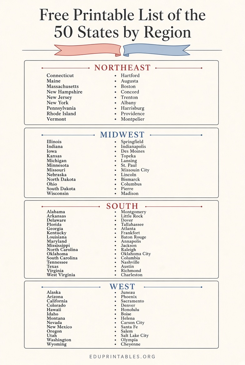
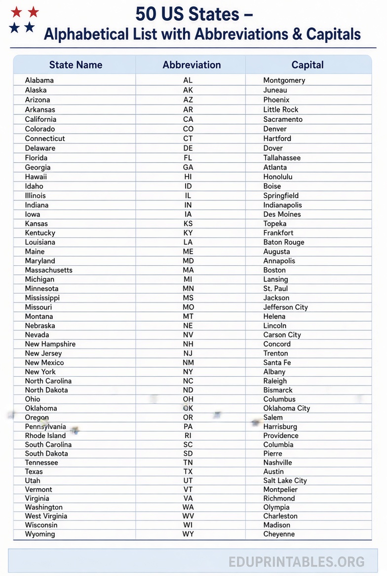
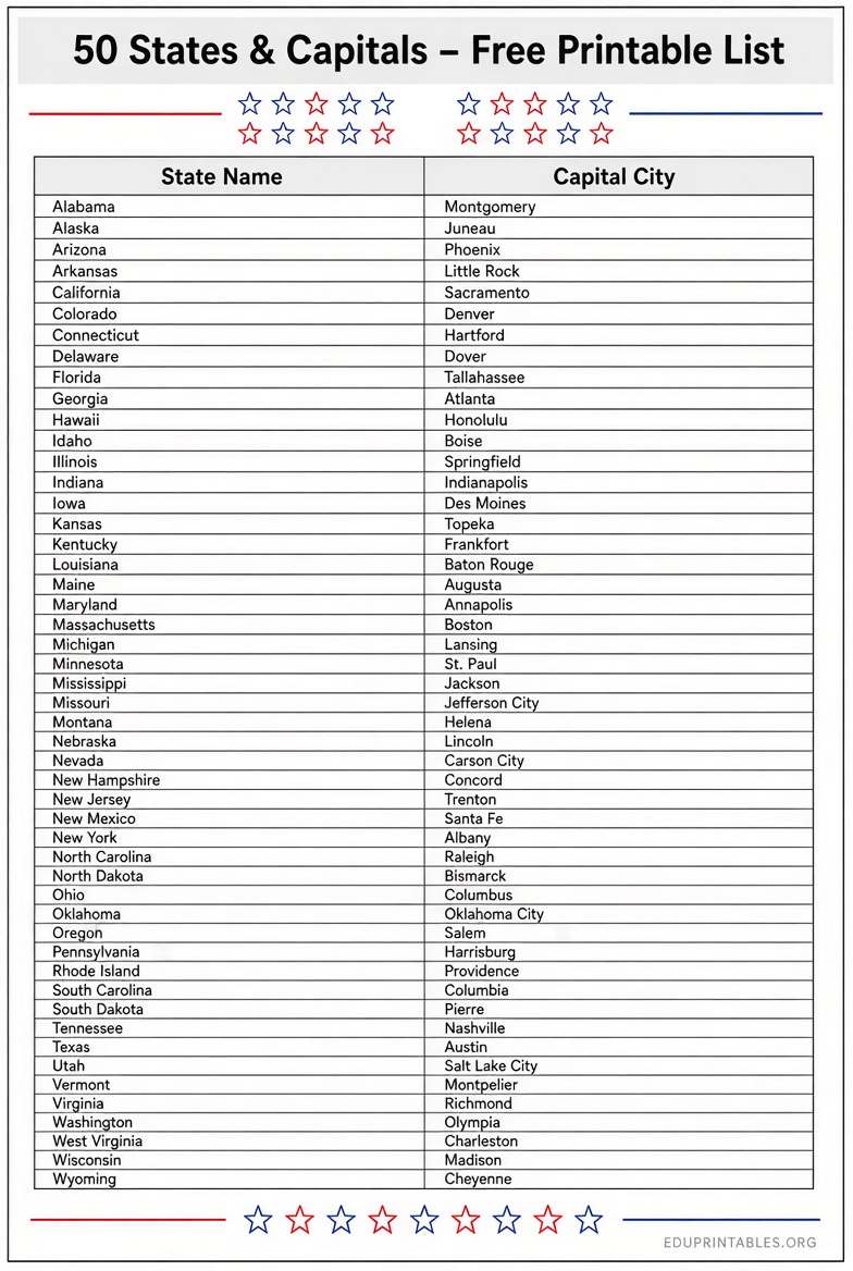
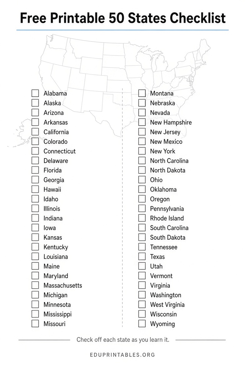
How to Use Your Free Printable List of 50 States?
Print one copy for reference and a second blank or quiz version for practice. Students can cover the capitals column and test themselves, or sort states by region after reviewing a map. Laminate a copy for repeated dry-erase use in classrooms. Pair the list with a labeled map for stronger location memory.
Quick Tips for Printing
Use standard letter paper and select “fit to page” or landscape orientation if the design requires it. Choose grayscale to conserve color ink. For multiple classroom copies, print on cardstock for durability.
FAQ
Is a free printable list of the 50 states really free?
Yes. The sources linked above provide free PDFs or print-ready pages for personal and classroom use without requiring payment.
Do these lists include capitals and abbreviations?
Most do. Check the description on each page; several include both capitals and the two-letter postal codes.
Can teachers use these in the classroom?
The linked resources generally allow personal and educational classroom use. Review any disclaimer on the download page.
Where can I find a blank version for quizzes?
Several of the sites above also offer blank maps or fill-in lists that work well with the completed reference sheet.
A free printable list of the 50 states is a simple, practical tool for learning U.S. geography. Download one of the trusted options above, print it, and keep it handy for study or teaching.