Free Printable Oahu Tourist Map Guide – Planning a trip to Oahu? A reliable printable tourist map helps you navigate Waikiki, the North Shore, Pearl Harbor, beaches, and scenic drives without relying solely on your phone. Cell service can be spotty in remote areas, and a paper map works offline for quick reference while driving or exploring.
This guide explains what a good printable Oahu tourist map includes, why it matters for U.S. travelers, and where to find legitimate free options from official and trusted sources.
Why Use a Printable Oahu Tourist Map?
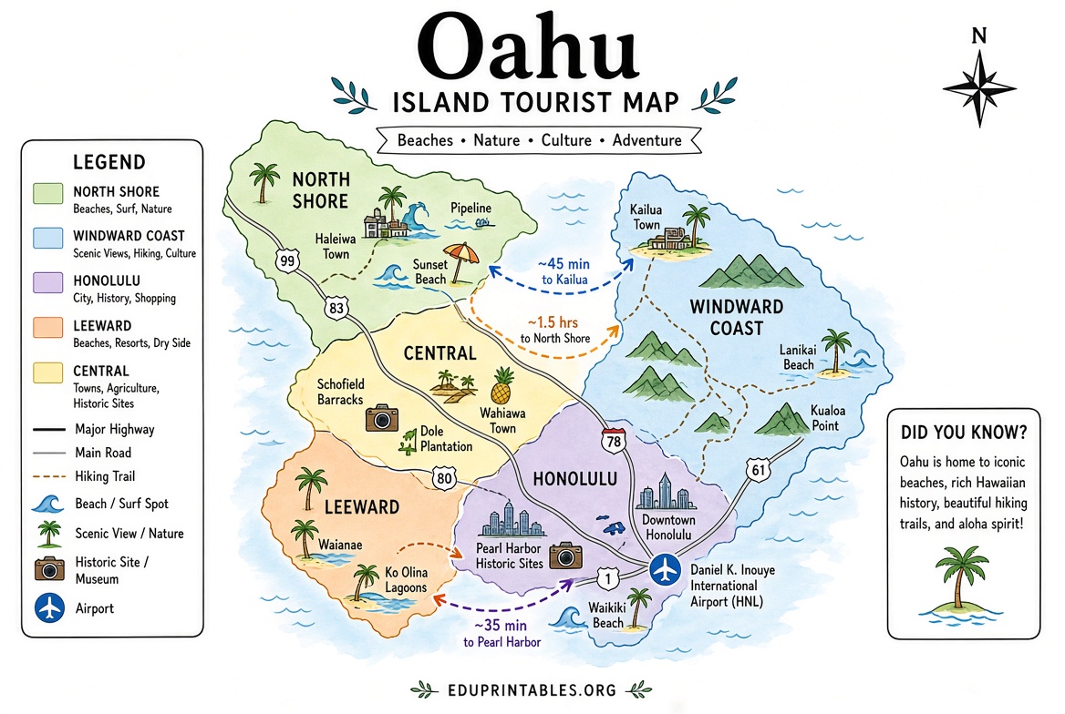
Oahu is compact (about 597 square miles) yet diverse, with distinct regions: Honolulu/Waikiki, North Shore, Windward Coast, Leeward/West Side, and Central Oahu. Major attractions sit relatively close, but traffic on H-1 and H-2 can add significant time.
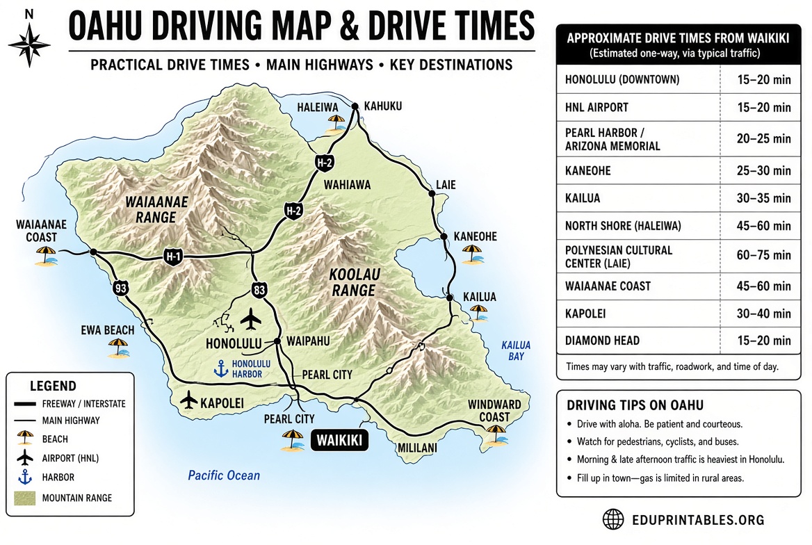
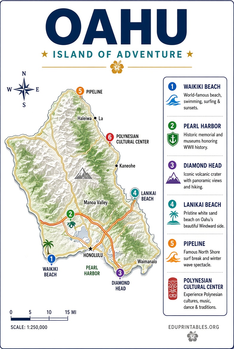
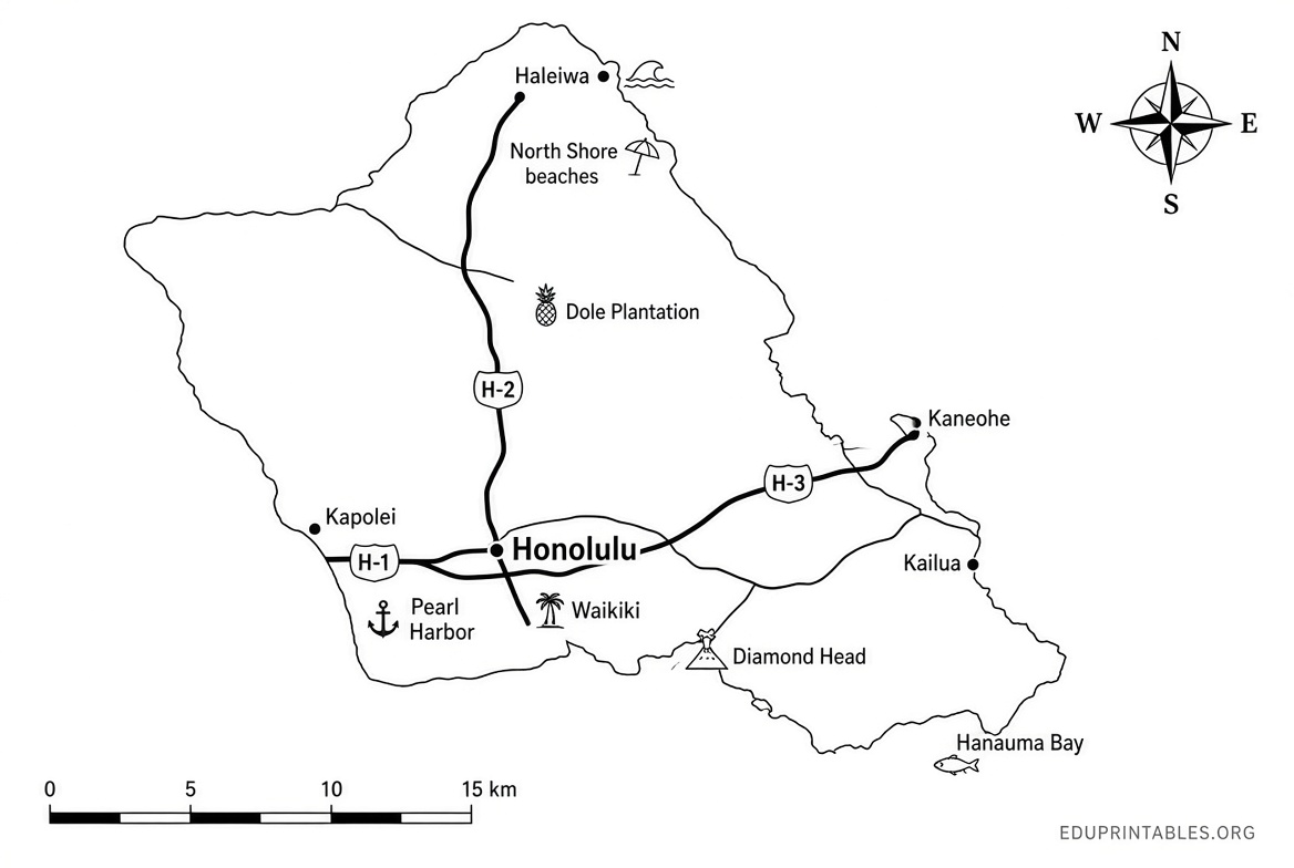
A clear printable map typically shows:
- Major highways and roads
- Key towns and neighborhoods
- Airports (primarily Daniel K. Inouye International Airport/HNL)
- Popular beaches, parks, and sights
- Approximate driving times from Waikiki or Honolulu
Printable maps help with itinerary planning before you leave, serve as a backup during the trip, and make it easy to mark favorite spots or share plans with travel companions.
Official Free Printable Oahu Driving Map
The most authoritative free resource comes from the official Hawaiʻi tourism site. GoHawaii (the Hawaiʻi Visitors and Convention Bureau) provides a downloadable PDF driving map of Oʻahu designed for visitors.
Download the free official PDF driving map of Oʻahu directly here:
Official Oahu Driving Map PDF (GoHawaii)
You can also visit the official maps page for the image version and additional island geography details:
GoHawaii Oahu Maps Page
This map highlights routes, key destinations, and practical driving information suitable for printing on standard paper.
Additional Free Printable and Viewable Oahu Maps
Several reputable travel resources offer free printable or high-resolution viewable maps of Oahu that focus on roads, attractions, beaches, and regions.
Hawaii-Guide.com provides multiple free printable Oahu maps, including road maps, topographic versions, neighborhood overviews, beaches maps, and more. Click any map on the page to view full size or download for offline/print use:
Hawaii-Guide Free Printable Oahu Maps
Moon Travel Guides offers free printable regional travel maps of Oʻahu (including Honolulu, Waikiki, and other areas) drawn from their guidebooks. These are useful for focused sightseeing:
Moon Travel Guides Free Oahu Maps
These sources prioritize accuracy and visitor usefulness. Always verify the most current version, as road conditions or attraction access can change.
Free Printable Oahu Tourist Map Guide
Tips for Using and Printing Your Oahu Map
- Print on letter-size (8.5 x 11) paper or larger if available. Color printing improves readability of terrain and labels.
- Laminate a copy or keep it in a clear sleeve for durability in humid or rainy conditions.
- Pair the map with a driving-times chart (many free maps include approximate times from Waikiki).
- Note major freeways (H-1, H-2, H-3) and the scenic coastal routes.
- Check for current road closures or construction via official Hawaii Department of Transportation resources before long drives.
- Use the map alongside your phone’s GPS for turn-by-turn directions, but keep the paper version as a reliable overview.
Focus first on the regions that match your itinerary. Most first-time visitors base themselves in Waikiki/Honolulu and day-trip to the North Shore, Windward side (Kailua/Lanikai), or Pearl Harbor area.
Brief FAQ
Is there a truly free official printable Oahu tourist map?
Yes. The GoHawaii official driving map PDF is free to download and print for personal use.
Can I print these maps for personal travel planning?
Yes, the linked official and travel-guide maps are intended for visitor use and personal printing.
Do these maps show beaches and attractions?
The official driving map focuses on routes and key points. Complementary free maps from Hawaii-Guide and Moon include more attraction, beach, and regional detail.
Should I still download offline maps on my phone?
Yes. Combine a printed overview map with offline Google Maps or Apple Maps for navigation.
A good printable Oahu tourist map keeps your island exploration simple and stress-free. Start with the official GoHawaii PDF, supplement with the free regional options above, and enjoy planning your Hawaiian adventure. Safe travels and aloha!