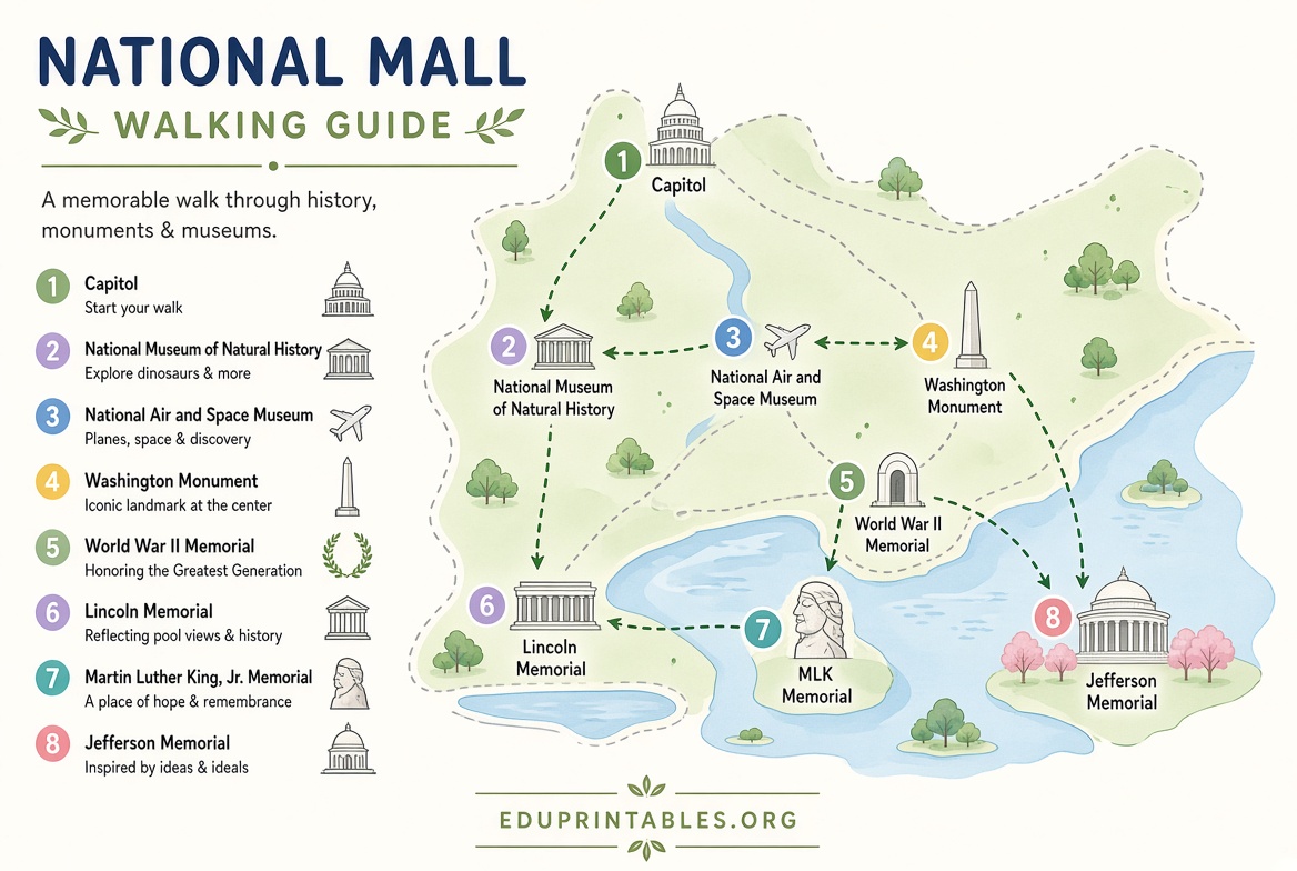
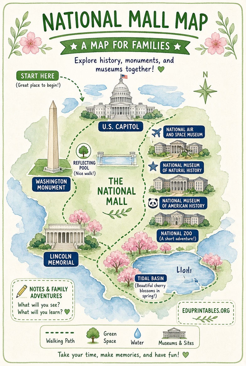
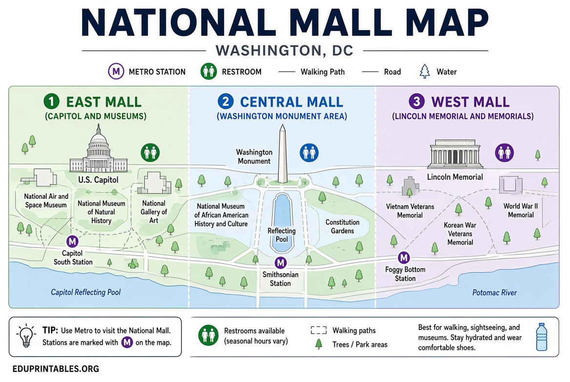
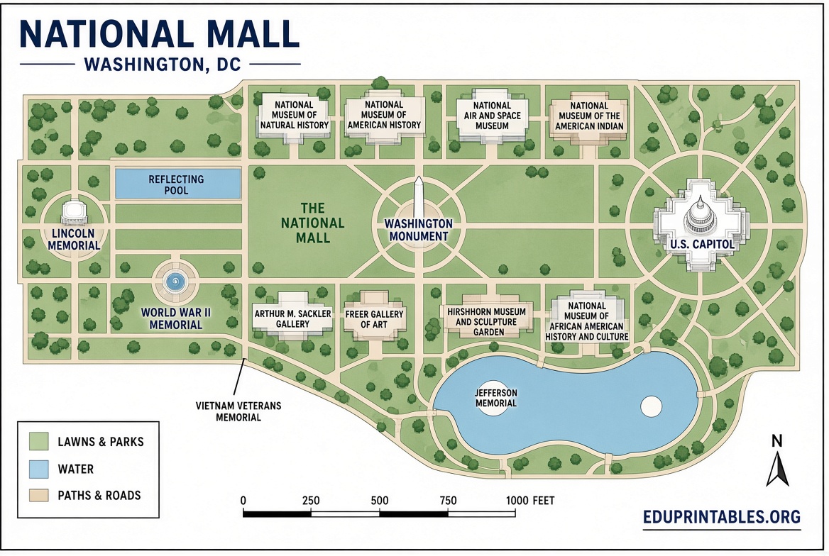
Free PDF Printable National Mall Map – A free PDF printable National Mall map is one of the best tools for planning a visit to Washington, D.C. The National Mall stretches more than two miles from the U.S. Capitol to the Lincoln Memorial and includes dozens of monuments, memorials, and Smithsonian museums. Carrying a printed map helps you navigate on foot, locate restrooms, and find Metro stations without relying solely on your phone.
What Is the National Mall?
The National Mall and Memorial Parks, managed by the National Park Service, is often called America’s Front Yard. It hosts iconic sites such as the Washington Monument, World War II Memorial, Vietnam Veterans Memorial, Martin Luther King Jr. Memorial, and the Lincoln Memorial Reflecting Pool. Nearby areas include the Tidal Basin and East Potomac Park. A clear map shows walking paths, bicycle routes, parking, and public transit options so you can plan an efficient route.
Where to Download a Free PDF Printable National Mall Map?
The most reliable free PDF printable National Mall map comes from official National Park Service materials. Several trusted sources offer direct downloads of the official brochure-style map that labels major attractions, Metro stations, restrooms, and visitor services.
- The official National Park Service maps page for National Mall and Memorial Parks provides current interactive maps for points of interest, accessible parking, and bike racks: NPS National Mall Maps.
- NPMaps hosts free National Mall maps derived from NPS brochures, including a detailed overview and a 3D version. Download the main map directly as a PDF: National Mall Map PDF. Browse additional free options here: NPMaps National Mall Collection.
- A public-domain version of the official NPS National Mall map is available on Wikimedia Commons for free download and printing: NPS National Mall Map PDF (Wikimedia).
- The National Mall Coalition offers free printed visitor maps that show monuments, museums, transit, food, and restrooms. Request copies by email or pick them up at listed partner locations: National Mall Coalition Free Maps.
These resources are free to view and download. Always check the official NPS site for the latest visitor alerts before your trip, as temporary closures or event restrictions can occur.
Free PDF Printable National Mall Map
How to Use Your Printable National Mall Map?
Start by identifying the eastern end near the Capitol and the western end at the Lincoln Memorial. Most first-time visitors focus on the central Mall between 3rd and 17th Streets. Mark the Smithsonian Metro stop, which sits in the middle and provides easy access to many museums. Note the locations of water fountains, restrooms, and food options, as they are limited in some sections. The map also highlights the Circulator bus route that runs along the Mall, useful if you prefer not to walk the full distance.
Pair the printed map with the free National Park Service app for real-time location and augmented-reality labels once you arrive. A paper map remains useful when battery life is low or cell service is crowded during major events.
Tips for Printing and Visiting
Print the PDF on letter-size paper in color if possible so landmarks and paths stand out. For a larger overview, select “fit to page” or use a slightly larger paper size. Laminating the map protects it from rain and wear. Bring a pen to mark your planned route or note operating hours for specific memorials.
Wear comfortable walking shoes and plan for several hours of outdoor time. Parking is limited and often expensive; Metro and Capital Bikeshare are more practical. Check weather forecasts, as much of the Mall is open green space with limited shade. During peak seasons or holidays, arrive early to avoid crowds at popular sites like the Lincoln Memorial and the National Air and Space Museum.
Frequently Asked Questions
Is the National Mall map free to download and print?
Yes. The official NPS-derived maps linked above are free PDFs available for personal use and printing.
Does the map include Smithsonian museums?
The standard National Mall overview shows the museums that line the Mall, along with nearby monuments and transit stops.
Are there maps for specific memorials?
NPMaps and the NPS site offer zoomed-in maps for sites such as the Martin Luther King Jr. Memorial and FDR Memorial in addition to the main overview.
How current are these maps?
The core layout of monuments and pathways changes rarely. Always cross-check the official NPS maps page for the latest visitor information before your visit.
A free PDF printable National Mall map makes it easier to explore Washington, D.C.’s most famous outdoor space. Download one of the official versions above, print it, and use it alongside the NPS website or app for a smoother visit.